FIRE - Fogo Island volcano: multi disciplinary Research on 2014 Eruption
About
Completed
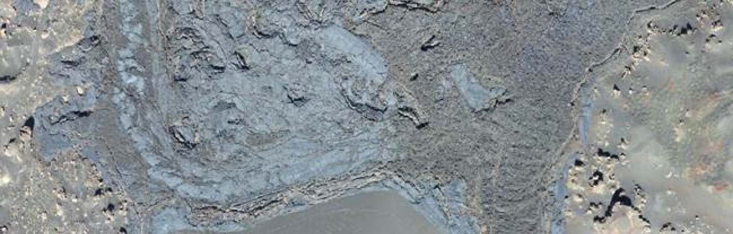
| Fogo, in the Cape Verde archipelago, is one of the most active oceanic island volcanoes in the world – it has erupted approximately every 20 years since the island was discovered in the 15th century. The most recent eruption of Fogo volcano started on Nov 23, 2014, and a few days later the Collaboratorium for Geosciences (C4G), a consortium included in the National Strategic Research Infrastructure Roadmap, received a request of collaboration from Instituto Nacional de Meteorologia e Geofisica (INMGCV) to assist the instrumental observation of the eruption. The request was readily accepted, and FCT exceptionally funded a mission to Fogo to collect geological, seismic, geodetic, and geochemical data. These rich datasets offer a unique opportunity to improve volcanic hazard assessment in the island and recommend on risk mitigation strategies. A recent study prepared for the United Nations Development Programme Office in Cape Verde (Fonseca et al., 2014) indicates that the present scenario – involving hawaiian/strombolian style eruptions through vents at the foot of Pico do Fogo – dominates volcanic hazard in the island. Although other, less likely eruptive styles cannot be excluded, a significant improvement of hazard assessment can be achieved through a detailed analysis of this scenario. This mission will be achieved through: 1. Improvement of the scientific knowledge of the plumbing system, through geological, morphostructural and geochemical investigations, complemented by microgravity surveying and seismic tomography; 2. Thorough characterization of the 2014 eruption dynamics, through the analysis of the associated seismicity data and geodetic signature, complemented with field observation and remote sensing data; 3. Lava flow modelling with a new digital elevation model derived with a UAV (drone), for a range of possible vent locations, associated with a probability density function derived from the previous eruptive history. The project’s activities converge into the following 3 transversal themes: i) volcanic structure (Past), ii) eruption dynamics (Present), and iii) strategies for risk mitigation (Future). |
Keywords
Environment
Natural and Technological Hazards
Remote Sensing
Start Date
CERENA Role
Partner
Coordinator/Local PI

Former Member
iFCT
CERENA Team
Proponent Institution
Universidade da Beira Interior
Partners
CERENA / Técnico Lisboa, Portugal
Faculdade de Ciências da Universidade de Lisboa (FCUL)
Instituto de Geografia e Ordenamento do Território (CEG/IGOT/ULisboa)
Instituto Português do Mar e da Atmosfera (IPMA)
Instituto Superior de Engenharia de Lisboa (ISEL/IPL)
Laboratório Nacional de Energia e Geologia (LNEG)
Universidade de Aveiro, GEOBIOTEC (GEOBIOTEC/UA)
Universidade de Coimbra (UC)
Universidade de Évora (UE)
Instituto Dom Luíz (IDL/ULisboa)
Funding Programme
PTDC/GEO-GEO/1123/2014
Total Funding
199 998,00 €
CERENA Funding
20 616,00 €