AULIS - Automated landslides inventory based on very high spatial resolution images
About
Completed
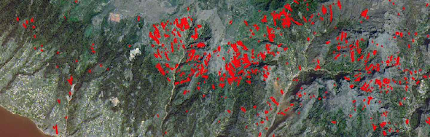
| The main objective of this research project is to give a major contribution to the inventory of landslides with a degree of completeness never achieved before. This objective was accomplished through the development of an automated methodology that uses a combination of remotely sensed and elevation data of very high resolution. The testing and validation of the methodology was mainly performed on Funchal and Ribeira Brava basins in Madeira Island using multitemporal satellite and aerial imagery together with elevation and field data. The approach permits a rapid construction or upgrade of landslides inventories and provides additional information for risk management policies. |
Keywords
Environment
Natural and Technological Hazards
Remote Sensing
Start Date
CERENA Role
Coordinator
Coordinator/Local PI

Former Member
iFCT
CERENA Team
Proponent Institution
CERENA, Portugal
Partners
Laboratório Regional de Engenharia Civil da Madeira (LREC-Madeira)
Funding Programme
PTDC/ECM/116611/2010
Total Funding
121 244,00 €
CERENA Funding
87 624,00 €